Gemakkelijke wandelpaden

Vooral in het dal en in de buurt van de avonturenparken zijn er heel wat gezinsvriendelijke en gemakkelijke wandelpaden, die deels ook goed toegankelijk zijn met een kinderwagen. De gondelbanen van Wilder Kaiser-Brixental brengen je omhoog of omlaag, zodat je niet het hele eind hoeft te lopen.

59 Routes & tochten

Hochschwendt circuit

Hochschwendt circuit

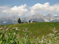
This easy family hike takes you via the Bergdoktorhaus to the Berggasthof Hochschwendt mountain inn.

Wanderstartplatz Tourist Info, Ellmau (800m)

Wanderstartplatz Tourist Info, Ellmau (800m)

Wandelen

Gemakkelijk

2:45 u

8,7 km

270 Hoogtemeters

11er-Kaiserblick circuit

11er-Kaiserblick circuit

Onto the Hausberg mountain with panoramic views of the Wilder Kaiser and Hartkaiser mountains and back via the Ranhartalm.

Hiking starting point Tourist Info, Ellmau (800 m)

Hiking starting point Tourist Info, Ellmau (800 m)

Wandelen

Gemakkelijk

8:00 u

22,8 km

1020 Hoogtemeters

Ötting-Horngach circuit

Ötting-Horngach circuit
Ötting-Horngach circuitaanbevolen
Ötting-Horngach circuit

Explore small places with farms, forests and views of the valley between Scheffau and Ellmau. 

Hiking starting point Tourist Info, Scheffau (737 m)

Hiking starting point Tourist Info, Scheffau (737 m)

Wandelen

Gemakkelijk

2:45 u

8,5 km

270 Hoogtemeters

Path of reflection

Path of reflection
Path of reflection
Path of reflection

Leisurely path of reflection to the St. Anna chapel at Lengau

Parkplatz Liftstation Itter (655 m)

Lengauer Kapelle

Wandelen

Gemakkelijk

1:15 u

3,2 km

270 Hoogtemeters

Tannbichl chapel circuit

Tannbichl chapel circuit

Nice circular hike through Going with visits to numerous chapels.

Hiking starting point Going center (former tourist information Going) (764 m)

Hiking starting point Going center (former tourist information Going) (764 m)

Wandelen

Gemakkelijk

2:45 u

9,3 km

210 Hoogtemeters

Hiking route Scheffau - Ellmau

Hiking route Scheffau - Ellmau
Hiking route Scheffau - Ellmauaanbevolen
Hiking route Scheffau - Ellmau

Hike along the sunny side along field paths and settlements from Scheffau to Ellmau..

Hiking starting point, Tourismus Info, Scheffau (737 m)

Bus stop Ellmau Bauhof/Dorf, Ellmau (800 m)

Wandelen

Gemakkelijk

1:30 u

5,7 km

100 Hoogtemeters

Ellmau circuit

Ellmau circuit
Ellmau circuit
Ellmau circuit

A beautiful easy hike at the foot of the Wilder Kaiser

Hiking starting point Tourist Info, Ellmau (800 m)

Hiking starting point Tourist Info, Ellmau (800 m)

Wandelen

Gemakkelijk

1:45 u

5,9 km

60 Hoogtemeters

“Moor & more” Rocky Way

“Moor & more” Rocky Way

An extensive exploration of the “Moor & more”. Exciting puzzle tour with Rocky through the Kaiserwald forest is sure to be lots of fun, even for older children.

Hiking starting point Hüttling, Going (820 m)

Hiking starting point Hüttling, Going (820 m)

Wandelen

Gemakkelijk

3:00 u

8,0 km

380 Hoogtemeters

Natural playground Rehbachklamm

Natural playground Rehbachklamm

Hikers, young and old alike, will find in this wild romantic gorge natural playgrounds such as bridges and balancing beams by streams and ponds.

Hiking starting point Tourist Info, Scheffau (738 m)

Hiking starting point Tourist Info, Scheffau (738 m)

Wandelen

Gemakkelijk

1:15 u

3,5 km

130 Hoogtemeters

Village tour Scheffau

Village tour Scheffau
Village tour Scheffauaanbevolen
Village tour Scheffau

Round tour through Scheffau with panoramic views, refreshment by the stream and slowing down in the forest.

Hiking starting point Tourist Info, Scheffau (738 m)

Hiking starting point Tourist Info, Scheffau (738 m)

Wandelen

Gemakkelijk

1:15 u

4,3 km

90 Hoogtemeters

Brandstadl circuit

Brandstadl circuit
Brandstadl circuit
Brandstadl circuit

A walk that lets you experience the Brandstadl mountain and leads you to Jochstubnsee lake.

Brandstadlbahn valley station, Scheffau (681 m)

Brandstadlbahn valley station, Scheffau (681 m)

Wandelen

Gemakkelijk

4:45 u

12,7 km

1130 Hoogtemeters

Schattseit route short

Schattseit route short
Schattseit route shortaanbevolen
Schattseit route short

Deceleration round with breathtaking views of the Wilder Kaiser.

Talstation Bergbahn, Söll (725 m)

Talstation Bergbahn, Söll (725 m)

Wandelen

Gemakkelijk

1:30 u

4,8 km

120 Hoogtemeters

Fitness circuit

Fitness circuit
Fitness circuit
Fitness circuit

Short, idyllic forest circuit with training opportunities in nature parkour.

Hiking starting point Franzlhof, Söll (703 m)

Hiking starting point Franzlhof, Söll (703 m)

Wandelen

Gemakkelijk

0:45 u

2,4 km

70 Hoogtemeters

Firster-Waldhof route

Firster-Waldhof route

Explore the districts of Paisslberg and Ried on a leisurely hike for everyone.

Hiking starting point Alpenschlössl, Söll (762 m)

Hiking starting point Alpenschlössl, Söll (762 m)

Wandelen

Gemakkelijk

1:30 u

4,4 km

100 Hoogtemeters

Reiter-Dörfl Tour

Reiter-Dörfl Tour
Reiter-Dörfl Tour
Reiter-Dörfl Tour

Through the districts of Ried and Paisslberg on a leisurely walk for everyone.

Hiking starting point Alpenschlössl, Söll (762 m)

Hiking starting point Alpenschlössl, Söll (762 m)

Wandelen

Gemakkelijk

0:30 u

2,0 km

50 Hoogtemeters

Hike to Wochenbrunner Alm

Hike to Wochenbrunner Alm

Hike from the centre of Ellmau, along trail no. 14, through the "Spatlahner gorge" up to the Wochenbrunner Alm.

Hiking starting point Tourist Info, Ellmau (800 m)

Hiking starting point Tourist Info, Ellmau (800 m)

Wandelen

Gemakkelijk

1:30 u

4,4 km

285 Hoogtemeters

Asten circuit

Asten circuit
Asten circuit
Asten circuit

From Going to the Astberg with a short  high-altitude loop & impressive panoramic view.

Hiking starting point Going center (former tourist information Going) (764 m)

Hiking starting point Going center (former tourist information Going) (764 m)

Wandelen

Gemakkelijk

3:30 u

8,6 km

560 Hoogtemeters

Sunnseit round (short)

Sunnseit round (short)
Sunnseit round (short)aanbevolen
Sunnseit round (short)

The Sunnseit circuit lives up to its name - this sunny circular hike leads through a varied landscape with fantastic views of Söll, the Wilder Kaiser, the Hohe Salve and the Pölven massif.

Hiking starting point Franzlhof, Söll (703 m)

Hiking starting point Franzlhof, Söll (703 m)

Wandelen

Gemakkelijk

2:15 u

7,3 km

180 Hoogtemeters

Bergdoktor tour of Ellmau

Bergdoktor tour of Ellmau
Bergdoktor tour of Ellmauaanbevolen
Bergdoktor tour of Ellmau

A tour of the main filming locations of the TV series “Der Bergdoktor” (The Mountain Doctor) in Ellmau, with a refreshment stop at the inn used during filming

Hiking starting point Tourist Info, Ellmau (798 m)

Hiking starting point Tourist Info, Ellmau (798 m)

Wandelen

Gemakkelijk

2:15 u

7,5 km

200 Hoogtemeters

War memorial circular route

War memorial circular route

This pleasant circular walk takes you to Söll’s war memorial in a beautiful section of forest.

Hiking starting point Tourist Info, Söll (689 m)

Hiking starting point Tourist Info, Söll (689 m)

Wandelen

Gemakkelijk

0:30 u

2,1 km

10 Hoogtemeters

Kaiseralm round hike

Kaiseralm round hike
Kaiseralm round hikeaanbevolen
Kaiseralm round hike

Short hike from Jägerwirt to the Kaiseralm with great mountain views.

Hiking starting point Jägerwirt, Scheffau (883 m)

Hiking starting point Jägerwirt, Scheffau (883 m)

Wandelen

Gemakkelijk

1:45 u

5,0 km

250 Hoogtemeters

Hausberg trail (no. 8)

Hausberg trail (no. 8)

Hiking trail no. 8 to the Hausberg via the Marienkapelle (St Mary’s Chapel).

Hiking starting point Tourist Information Office, Ellmau (798 m)

Brenner Alm, Ellmau (1,236 m)

Wandelen

Gemakkelijk

3:00 u

7,5 km

440 Hoogtemeters

Salvenblick hiking round

Salvenblick hiking round

Comfortable round with a magnificent view of the Hohe Salve.

Mountain station gondola Hexenwasser, Söll (1,150 m)

Mountain station gondola Hexenwasser, Söll (1,150 m)

Wandelen

Gemakkelijk

0:35 u

1,8 km

50 Hoogtemeters

Bathing lake circular walk

Bathing lake circular walk

This short and easy valley circuit takes you around the village of Going am Wilden Kaiser and past the bathing lake, a delightful spot to cool off in fine weather.

Hiking starting point Going center (former tourist information Going) (764 m)

Hiking starting point Going center (former tourist information Going) (764 m)

Wandelen

Gemakkelijk

1:00 u

6,4 km

110 Hoogtemeters

Schwendt circuit

Schwendt circuit
Schwendt circuit
Schwendt circuit

Leisurely hike through forest and across meadows to the sunny plateau of Going and back

Hiking starting point Going center (former tourist information Going) (764 m)

Hiking starting point Going center (former tourist information Going) (764 m)

Wandelen

Gemakkelijk

1:15 u

4,1 km

70 Hoogtemeters

Koller circular route

Koller circular route
Koller circular routeaanbevolen
Koller circular route

Ancient path of the romans - a better stroll.

Hiking starting point Tourist Info, Söll (689 m)

Hiking starting point Tourist Info, Söll (689 m)

Wandelen

Gemakkelijk

1:00 u

3,0 km

55 Hoogtemeters

Ellmau village tour

Ellmau village tour
Ellmau village tour
Ellmau village tour

Postkarten circuit Ellmau Ellmau hiking info point – Kapellenpark – Marienkapelle – Ellmau Parish Church

Hiking starting point Tourist Info, Ellmau (800 m)

Hiking starting point Tourist Info, Ellmau (800 m)

Wandelen

Gemakkelijk

0:25 u

1,3 km

40 Hoogtemeters