Eagle Walk Stage 03: Kaindlhütte - Kufstein

Eagle Walk Stage 03: Kaindlhütte - Kufstein

Description

Starting point: Kaindlhütte hut

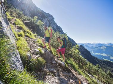
Follow the Bettlersteig trail (marked as trail number 827) from the Kaindlhütte hut heading east, passing the Steinbergalm hut. The trail leads over a saddle to the right of the Brandkogel mountain. Take the left trail towards Gamskogel mountain. Beneath the Brandkogel and Taxköpfl mountains, the trail leads to the peak of the Gamskogel at 1,449 metres. Continue heading west and downhill until you reach the Brentenjochalm hut (at 1,208 metres) after about two kilometres. Now take the panoramic Jochboden trail leading downhill through a forest. When you reach the Schneerosenweg fork, head right and turn left onto the Brentenjoch/Duxer trail after the Duxer Alm hut. Hikers will now walk down to Kufstein along and above the Kienbach stream. Walk along the Kienbergstraße and Georg-Pirmoser-Straße roads to reach the Inn river. Cross the bridge to reach Kuftstein train station.

Finishing point: Kufstein


Read more

Information

    Read more

    • Fitness

    • Technical

    Best seasons

    • 01

      Jan

    • 02

      Feb

    • 03

      Mrz

    • 04

      Apr

    • 05

      May

    • 06

      Jun

    • 07

      Jul

    • 08

      Aug

    • 09

      Sep

    • 10

      Oct

    • 11

      Nov

    • 12

      Dec

    More tours

    Kaiserblüte - Rock Stage

    Kaiserblüte - Rock Stage
    Kaiserblüte - Rock Stage
    Kaiserblüte - Rock Stage

    This scenic stage leads you into the rugged world of rock – across rocky trails and scree fields to the strikingly positioned Gruttenkreuz cross, nestled beneath the towering cliffs of the Wilder

    Hiking starting point Tourist Info, Scheffau (737 m)

    Wochenbrunner Alm, Ellmau (1,085 m)

    Hiking

    Intermediate

    5:30 h

    12,7 km

    1030 Elevation gain

    Rauher Kopf

    Rauher Kopf
    Rauher Kopf
    Rauher Kopf

    Over hill and dale through idyllic nature up to the Rauhen Kopf.

    Astberg Bergstation

    Astberg Bergstation

    Hiking

    Intermediate

    4:45 h

    13,1 km

    620 Elevation gain

    Weather

    Today

    2026-04-07

    6 °C

    • Valley
    • 5 km/h
    • 10° Mountain
    • 0 %

    Tomorrow

    2026-04-08

    15 °C

    • Valley
    • 10 km/h
    • Mountain
    • 0 %

    The day after tomorrow

    2026-04-09

    14 °C

    • Valley
    • 10 km/h
    • Mountain
    • 40 %

    2026-04-10

    2026-04-10

    7 °C

    • Valley
    • 10 km/h
    • Mountain
    • 65 %
    More

    Contact

    If you have any questions,we are happy to help.

    +43 50509
    or